We use cookies to give you the best experience on our website. If you continue to browse, then you agree to our privacy policy and cookie policy.


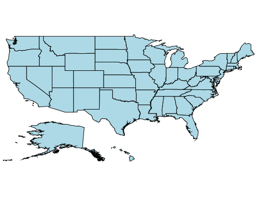
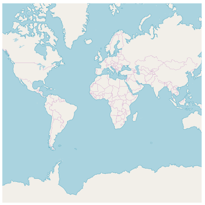
The UWP Map control is a powerful data visualization component that displays statistical information for a geographical area. It has highly interactive and customizable features such as zooming, panning, selecting, legends, markers, bubbles, and color mapping. Using the Map control,you can render various maps, such as sales, political-boundary, weather, electoral, and route maps.
Render geographical shapes or custom shapes in UWP Map.

Bind shapefiles (.shp) and GeoJSON (.json) data to maps to render any geometric shape.
Customize the default style of a shape using the color, stroke, and thickness properties.
Render any custom shape to represent building infrastructure, a sports stadium, plane or bus seat arrangements, and more.

Load multiple shape files in a single map view. For example, add a sublayer over a main shape layer to view geographic features such as rivers, valleys, and cities in a map of a country.
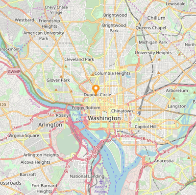
Built-in support for external imagery services, such as Bing Maps and OpenStreetMap, is used to visualize satellite, aerial, and street maps, and other imagery tiles, without using shapefiles. Apart from Bing Maps and OpenStreetMap, you can also render maps from other map providers such as Google Maps and TomTom.
OpenStreetMap (OSM) is a map of the world built by a community of mapmakers that is free to use under an open license. It allows users to view geographical data in a collaborative way from anywhere on Earth.
Bing Maps, owned by Microsoft, is a map of the entire world. It supports three types of map views: Aerial, Aerial with Labels, and Road.
Set the initial zoom level automatically based on map Geo-bounds or distance (KM/miles) from the Geo-point center value.
Easily annotate UWP Map shapes with labels to improve the readability of a particular shape’s name.
Customize the look and feel of default labels using font style, size, and color properties.

Align labels smartly within shape boundaries and trim or hide them to avoid labels overlapping.
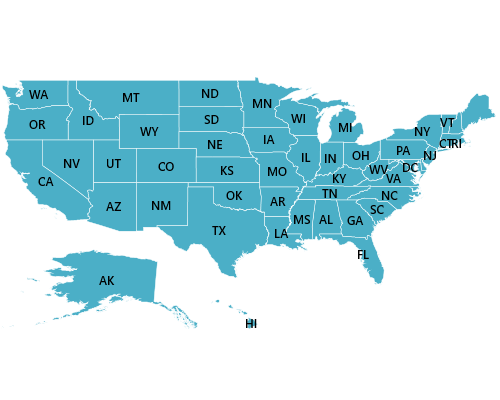
Produce a heat map by customizing shape colors based on the underlying shape value.

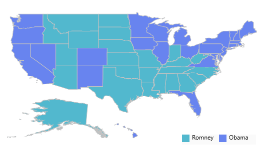
Equal color mapping differentiates a shape’s fill color based on its underlying value and color. For example, apply colors to states based on their winning political candidates.

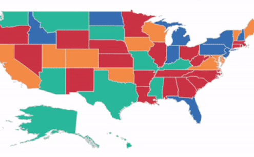
Apply colors to shapes by comparing their values with desired numeric ranges. For example, apply colors to states based on their population density.
Markers allow you to denote a place with symbols, like pins, or display a message at specific coordinates on a map.
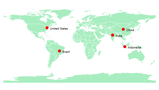
Set the marker type to built-in shapes such as circles, diamonds, rectangles, or squares to highlight a place.
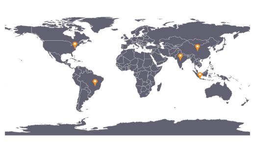
Customize markers by adding images or any custom shape to highlight a location.
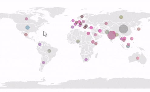
Bubbles are used to add information to shapes, such as population density, land area, and more. They are rendered with various magnitudes and colors based on the underlying data values of the shapes.
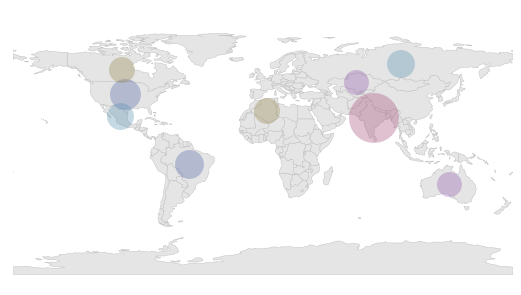
Customize the default color of a bubble and its transparency using the fill and opacity properties.
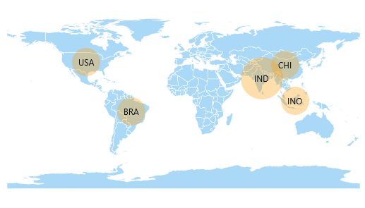
Customize the minimum and maximum size of a bubble to enhance its readability.
Legends provide valuable information for interpreting maps by using colors, shapes, or other identifiers based on data.
Move a legend to any position inside a map.
![]()
The default size of a legend icon can be customized.
Interactive features such as selecting, zooming, and panning greatly enhance user experience.
Select or highlight an area or shape in order to center the view over that area on a map.
Zooming allows users to get a closer look at a particular area, and panning allows users to move a map around to focus on a specific area.
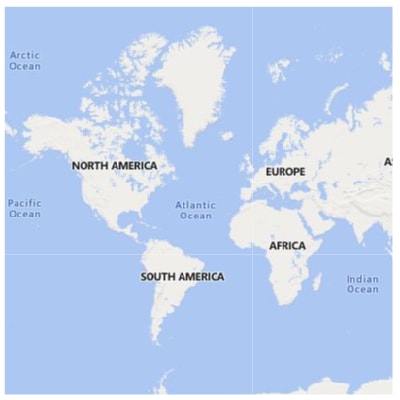
Drill down in a map to display different shape data located on another layer. For example, you can drill down to a continent in a world map to show the continent separately on another layer.
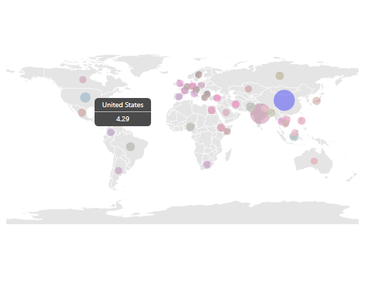
The tooltip control displays a pop-up with additional information about the shapes, markers, and bubbles when the end user taps the map elements.


 Documentation
Greatness—it’s one thing to say you have it, but it means more when others recognize it. Syncfusion is proud to hold the following industry awards.